|
| *****SWAAG_ID***** | 999 |
| Date Entered | 04/06/2017 |
| Updated on | 04/06/2017 |
| Recorded by | Tim Laurie |
| Category | Burial Mounds and Cairns |
| Record Type | Archaeology |
| Site Access | Public Access Land |
| Record Date | 03/06/2017 |
| Location | Cotherstone Moor |
| Civil Parish | Cotherstone |
| Brit. National Grid | NY 908 171 |
| Altitude | 454m |
| Geology | Namurian sandstone over shales |
| Record Name | Shacklesborough. Prehistoric summit cairn. |
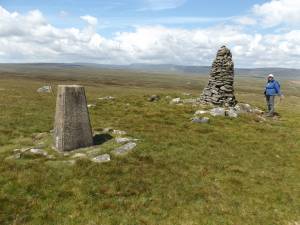
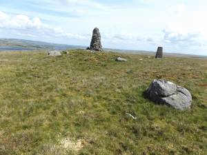
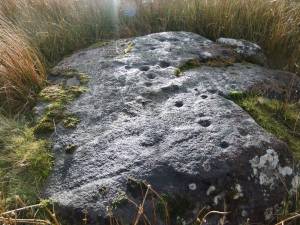
| Record Description | Both these isolated hills are of archaeological interest. Goldsborough, the easterly of the two hills is the focus location of cup and ring marked rocks, see SWAAG Record No 645.Careful examination reveals that Shacklesborough, the more distant and westerly of these two prominent hills possesses the 8m diameter low summit cairn shown on the photographs below. |
| Dimensions | 8m diameter and <1.0m high |
| Additional Notes | Both these isolated hills are well worth a visit. Both Goldsborough and Shacklesborough are located within the finest North Pennine moorland landscape with limitless views westward across pristine moorland. Blencathra and the Lake District Hills can be seen on a clear day from Shacklesborough. The views north westward to Mickle Fell and the Pennine Escarpment are very fine. |
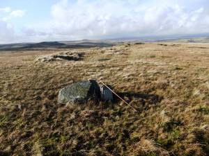
| Image 1 ID | 7383 Click image to enlarge |
| Image 1 Description | Distant view of Shacklesborough from Goldsborough. |  |
| Image 2 ID | 7385 Click image to enlarge |
| Image 2 Description | Shacklesborough. The prehistoric summit cairn underlies the recent stone cairn. |  |
| Image 3 ID | 7386 Click image to enlarge |
| Image 3 Description | Shacklesborough. The prehistoric summit cairn underlies the recent stone cairn. |  |
| Image 4 ID | 7382 Click image to enlarge |
| Image 4 Description | Cup and ring marked rock on the eastern ridge of Goldsborough, see previous SWAAG Record N0 645 |  |


